I1GXV Web Site
Main menu
- Home Page
- Tools & News
-
English
- Introduction
- Introduction to Ham Radio world
- About me
- My activity
- My shack
- My antennas
- Meteo
- My location
- Digital Elevation Model
- Photo Gallery 1
- Photo Gallery 2
- Photo Gallery 3
- QSL Gallery
- My Ham Links 1
- My Ham Links 2
- Ham Software, technical articles and presentations
- My DEM, Meteo & Lake Maggiore Links
- They say about us 1
- They say about us 2
- To contact me
-
Italiano
- Introduzione
- Introduzione al mondo dei Radioamatori
- Mie notizie
- La mia attività
- Il mio shack
- Le mie antenne
- Meteorologia
- La mia posizione
- Modelli digitali del terreno - DEM
- Galleria Foto 1
- Galleria Foto 2
- Galleria Foto 3
- Galleria QSL
- I miei Ham Links 1
- I miei Ham Links 2
- Ham Software, articoli e presentazioni tecniche
- I miei Links per DEM, meteo e per il Lago Maggiore
- Dicono di noi 1
- Dicono di noi 2
- Per contattarmi
- Introduction
- Introduction to Ham Radio world
- About me
- My activity
- My shack
- My antennas
- Meteo
- My location
- Digital Elevation Model
- Photo Gallery 1
- Photo Gallery 2
- Photo Gallery 3
- QSL Gallery
- My Ham Links 1
- My Ham Links 2
- Ham Software, technical articles and presentations
- My DEM, Meteo & Lake Maggiore Links
- They say about us 1
- They say about us 2
- To contact me
Digital Elevation Model

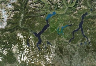
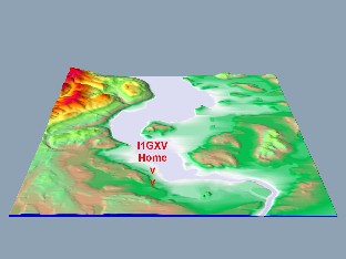
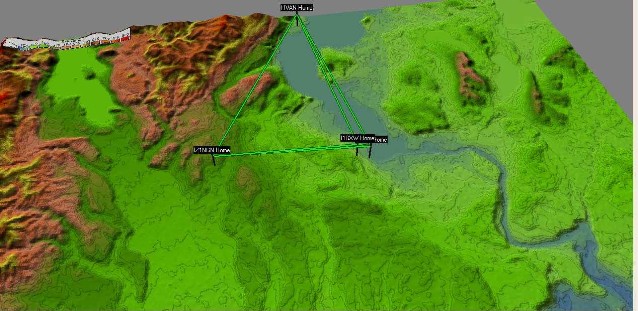
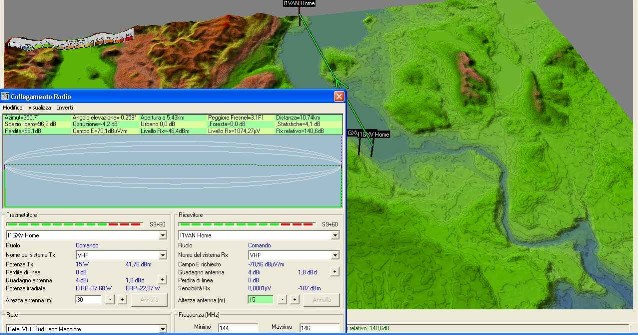
An interest always crossing my mind but only recently developed in a deeper way, is about the digital modeling of the terrain: for sure the chemical background and geological interest have played well so I have connected them to my target to better understand the behavior and working conditions of my antennas by means of ham software and digital elevation modeling applications.
A great support on these matters comes from "Radio Mobile", a program developed by VE2DBE and presented at www.ve2dbe.com.
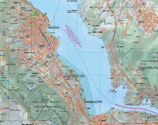
Thanks to this program I have been able to verify some antenna performance, taking into consideration the characteristics of the soil surrounding my block (built on lime and sandy layers due to the glacial origin of the lake), the effect of the lake water beaming north-
Some results of my tests based on Radio Mobile and on some other software for G.I.S. and D.E.M. applications with the related site links are reported in my pages.